Objects
Where we apply it
- Land plots and territories
- Construction sites
- Industrial facilities
- Roads, driveways and landscaping
- Facades, roofs and high elements
- Parks, courtyards and urban spaces

Coordinates, levels and deviations
for designers, site teams and contractors
Topographic plans, stakeout, as-built survey and DWG/PDF/CSV/BIM delivery
Topographicplan
Coordinatebasis
As-builtsurvey
Data formatsDWG, PDF,CSV, Revit
Existing plans are outdated, incomplete or unsuitable for design work.
Levels, boundaries, site elements and engineering networks must be recorded.
Before installation, concreting or handover, the actual position must be verified.
Data must align with BIM, point clouds, drawings and contractors.
Complex objects need geodetic control for laser scanning and photogrammetry.
A geodetic basis helps verify site reality before an error turns into rework, a contractor dispute or a schedule break.
Axes, levels and control points are fixed in a clear coordinate system for contractors and technical supervision.
Position control lowers the risk of discovering deviations after concreting, installation or finishing.
As-built surveys and schedules create a verifiable basis for discussing facts, not opinions.
Timely checks of levels, boundaries and actual position help keep the next construction stage moving.
The scope is selected for the object: from point stakeout to a topographic survey and laser scanning alignment.
For the first budget orientation we use common Russia market ranges. After the address, boundaries, access and required output are known, we clarify the scope and estimate.
within 1 business day
Address, boundaries, task and required delivery formats are enough to start.
same day
Possible when site access is ready and a field team window is available.
from 35-90k RUB
Depends on area, site density, relief and topographic plan requirements.
from 20-60k RUB
For axes, levels, structures and site engineering documentation.
from 60-150k RUB
For territories, roofs, facades, orthophotos and surface models.
individual
Area, access, site density, coordinate system, formats and urgency affect the estimate.
These anchors are not a public offer. Exact scope, price, timing and responsibility are fixed in the contract.
The client does not buy the visit itself; the value is a clear basis for construction, design, site engineering and disputed situations.

DWG plan, coordinate schedule, PDF report and CAD/BIM-ready materials are handed off in one structured archive.

Field measurements help verify axes, levels and actual position before the next work stage.

For larger sites and roofs, geodesy can be combined with UAV capture, orthophotos and a surface model.
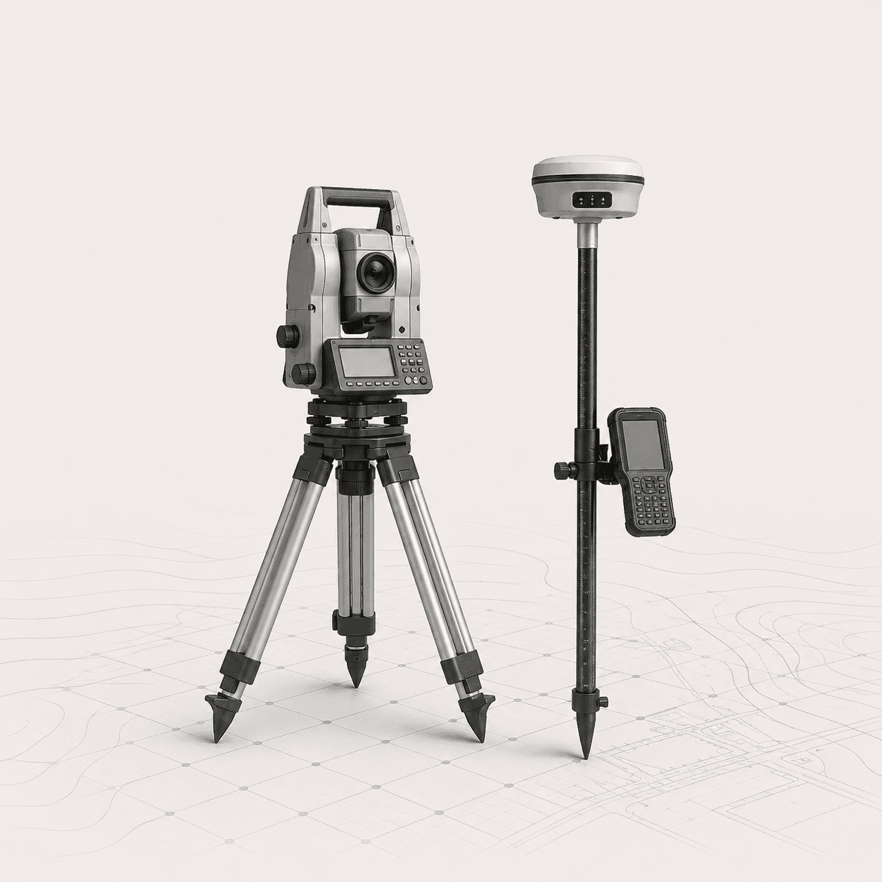
Satellite measurements for coordinate basis and object alignment.
Precise angle and distance measurements for topography and stakeout.
Geodesy plus scanning for complex geometry and 3D data.
Aerial capture for territories, roofs, facades and hard-to-reach zones.
We collect address, site boundaries, accuracy requirements and target formats.
We fix scope, access, coordinate system and schedule.
We arrive with GNSS, total station, scanner or UAV depending on the task.
We combine measurements, check accuracy, prepare drawings, schedules and archive.
We hand off materials in required formats and answer project team questions.
The address, site boundary and desired result are enough to start. Existing plans, design files or coordinate systems help us prepare faster.
For a mixed task, selecting the right method combination upfront is cheaper, faster and lowers the risk of repeat visits.
Select the work scope| Method | Best fit | What it provides | When one method is not enough |
|---|---|---|---|
| Geodesy | Coordinates, levels, stakeout, as-built surveys and topographic plans. | A verifiable basis for construction, site engineers, designers and contractors. | Does not replace a dense point cloud inside a complex building or facade. |
| Laser scanning | Complex geometry, facades, interiors, equipment and reconstruction. | Dense point cloud, 3D basis, drawings and BIM from actual conditions. | Without geodesy it may not solve the shared coordinate system for the site. |
| Measured surveys | Rooms, simple plans, renovation, design and local measurements. | Plans, dimensions, elevations and DWG/PDF documentation set. | Not suitable for stakeout, levels, coordinate basis or large territories. |
| UAV / photogrammetry | Orthophotos, territories, roofs, facades and visual capture. | Orthophoto, 3D/mesh, surface model and visual materials. | Needs geodetic alignment and control points for reliable metric output. |
Send the address, work boundaries and task. We will suggest the scope, timeline and delivery format.
No full technical brief is required: send the address, work boundaries and desired result. If you have an old plan, project file, photos or coordinate system, attach them, but you can submit the request without files.
Service: Geodesy